Sycamore Falls: Northern Arizona’s Best Kept Secret
As much as we love exploring faraway destinations, we realize just how lucky we are to live in Arizona where there is so much beauty to explore in our own backyard. Even after living here for 17 years, we are continually finding new places that take our breath away, like Sycamore Falls.

Everything you need to know before visiting Sycamore Falls
How to get to Sycamore Falls:
Located about 1 1/2 hours south of the Grand Canyon, you’ll find another impressive yet lesser-known Canyon.
Sycamore Canyon is a 21-mile scenic Canyon that begins in the thick Ponderosa Pine forests near Williams and ends in the desert landscape of Verde Valley.
Sycamore Falls can be reached by car and is located at the upper head of the canyon at Paradise Forks.
To drive to Sycamore Falls, take exit 178 off of I-40 just east of Williams. Head south on Garland Prairie Road. It will soon turn into FR 141, a well-maintained forest service road that you’ll follow for about 9 miles.
Take a right on White Horse Lake Rd/FR 109 and follow for about 3 miles to the parking lot and trailhead. Alternatively, if you put Sycamore Falls in your GPS it should take you directly to the parking lot.
Hiking to Sycamore Falls:
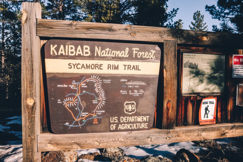
The trail to view Sycamore Falls is only about 1/4 mile from the parking lot. Once you arrive at the small parking lot, you will see the trailhead just to the left of the sign. There are also restrooms located at the trailhead.
